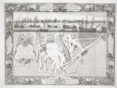
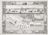
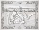
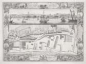
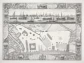
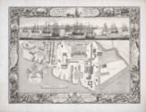
A Geometrical Plan, & West Elevation of His Majesty’s Dock-Yard, near Portsmouth, with Part of the Common, &c.
A Geometrical Plan, & West Elevation of His Majesty’s Dock-Yard, near Portsmouth, with Part of the Common, &c.
One of a series of views of the six Royal Dockyards, which were by the mid-eighteenth century the world's largest industrial complex and the state's biggest investment. These engravings present the dockyards as orderly, efficient, and rational; each makes reference to the specific functions of the dockyard represented, which depended in part on location. When France replaced Holland as Britain's major rival in the late seventeenth century, Plymouth and Portsmouth became the more strategically significant yards, serving as naval bases and fleet rendezvous for campaigns in the Atlantic and the Channel respectively. Chatham, Plymouth and Portsmouth, where the fleets moored during the winter or while on reserve, became employed more in repairs than shipbuilding.The cartouche on the left side of this print describes the content of the vignettes bordering the primary image. It is inscribed as follows: “References to Eight of the Twelve Capital Ships taken from the French the 3rd of May and 17th of October 1747 as Drawn in the Border.” Thus, rather than illustrating scenes in a ship’s “biography” (as is typical for other prints in this series), the ships shown in the vignettes bordering this print serve as a record of the activities of the dockyard at a particular moment.
