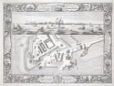
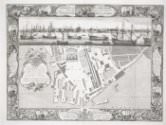
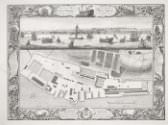
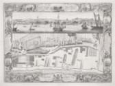
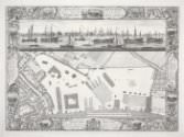
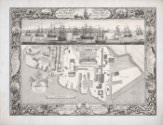
A Geometrical Plan, & West Elevation of His Majesty’s Dock-Yard and Garrison, at Sheerness, with the Ordnance Wharfe, &c.
A Geometrical Plan, & West Elevation of His Majesty’s Dock-Yard and Garrison, at Sheerness, with the Ordnance Wharfe, &c.
One of a series of views of the six Royal Dockyards, which were by the mid-eighteenth century the world's largest industrial complex and the state's biggest investment. These engravings present the dockyards as orderly, efficient, and rational; each makes reference to the specific functions of the dockyard represented, which depended in part on location. In November 1750, when employed at the Deptford dockyard, John Cleveley wrote to the Navy Board (which oversaw the dockyards) to notify them that he had, “In Pursuance to your Order of the 28 of September,” traveled to Sheerness to make a drawing of the Amazon, “and also a sketch of that Port,” for which service he was paid 6s 8d per day; it is tempting to surmise that the sketch was made for the purpose of the dockyard views. In accordance with its function as a dockyard primarily used for ship repairs, the vignettes bordering the primary image in this print show methods of repair and upkeep, including a view of a ship “heaving down” at Port Mahon, the navy’s main base in the Mediterranean.
